There is a specific kind of silence you only find at 11,000 feet in the High Sierra. It’s a silence broken only by the rhythmic click of trekking poles and the occasional whistle of a marmot. For many of us, the John Muir Trail (JMT)—or Nüümü Poyo as it is traditionally known by the indigenous Mono people—is more than just a 211-mile trek through California’s "Range of Light." It’s a pilgrimage.
Having navigated the granite staircases of the Golden Staircase and weathered the afternoon thunderstorms on Muir Pass, I can tell you: the JMT doesn't just happen. It requires a level of logistical precision that would make a military general blush. Whether you’re a seasoned ultralighter or a first-time thru-hiker, the 2025 season is shaping up to be an epic year for the Sierra. But before you can stand atop Mt. Whitney at sunrise, you have to survive the "lottery of pain" and the resupply puzzle.
Quick Facts: The JMT at a Glance
- Total Distance: 211 miles (standard JMT) + 11 miles to finish at Whitney Portal.
- Total Elevation Gain: Approximately 46,000 feet.
- Total Elevation Loss: Approximately 38,000 feet.
- Average Duration: Most hikers complete the trail in 21 days, though it can range from 14 to 28 days depending on pace.
- Best Time to Hike: July and August are prime. September offers fewer bugs and crowds but brings colder nights and a higher risk of early snow.
- Permit Success Rate: Only about 33% of applicants successfully secure a permit through the summer lottery system.
The 2025 Permit Strategy: Beating the Lottery
Getting a permit is arguably harder than the climb up Forester Pass. For 2025, the National Park Service continues to use the Recreation.gov lottery system, and you need to be strategic to increase your odds.
The 60/40 Rule In Yosemite (where most Southbound/SOBO hikers begin), 60% of permits are released via a rolling lottery exactly 24 weeks (168 days) in advance. The remaining 40% are released on a first-come, first-served basis 7 days before the start date at 7:00 AM PT.
Pro Tip: If you strike out in the initial lottery, don't lose hope. Set your alarm for that 7-day window. I’ve seen many a "hail mary" trip saved by a quick finger on a Tuesday morning.
Choosing Your Entry Point Your choice of trailhead determines your fate.
- Donohue Pass Eligible Trailheads: If you want to hike the full JMT SOBO, you must secure a permit for Lyell Canyon or Happy Isles that includes "Donohue Pass Exit." These are the most competitive permits in the world.
- The NOBO Alternative: Starting Northbound (NOBO) from Cottonwood Pass or Horseshoe Meadow (near Lone Pine) is often easier for permits. You’ll end your hike in Yosemite Valley, though you’ll have to tackle the massive climb to Whitney with a heavy pack on day one or two.
Check 2025 Permit Availability →
Best Time to Hike: Weather, Bugs, and Snow
Timing is everything in the Sierra. When I hiked the JMT during a high-snow year, I was still postholing in mid-July.
- July: The flowers are blooming, and the creeks are roaring. However, the "Sierra Air Force" (mosquitoes) is at its peak. Expect to wear head nets and bathe in DEET.
- August: This is the "Goldilocks" month. The snow has melted from the high passes, river crossings are manageable, and the bugs have mostly died down. This is the busiest time on trail.
- September: My personal favorite. The air is crisp, the crowds are gone, and the light is hauntingly beautiful. The trade-off? Water sources begin to dry up, and a rogue snowstorm can end your trip early.
Always check the Postel’s Snow Water Equivalent reports before your start date. If the Sierra is at 150% of its normal snowpack, a July 1st start date will feel more like mountaineering than hiking.
The Ultimate 21-Day JMT Itinerary
This itinerary assumes a Southbound (SOBO) direction, which is the classic way to experience the trail's gradual build toward the high-altitude climax of Mt. Whitney.
| Day | Segment | Distance (mi) | Elev. Gain/Loss (ft) | Key Landmark |
|---|---|---|---|---|
| 1-3 | Yosemite Valley to Tuolumne | 23 | +6,200 / -1,100 | Nevada Fall & Lyell Canyon |
| 4-6 | Donohue Pass to Reds Meadow | 35 | +5,500 / -6,800 | Thousand Island Lake |
| 7-10 | Reds Meadow to VVR/MTR | 48 | +9,200 / -8,500 | Silver Pass & Lake Thomas Edison |
| 11-14 | Evolution Basin to Muir Pass | 32 | +6,100 / -4,800 | The Muir Hut & Evolution Creek |
| 15-18 | The Big Passes (Mather, Pinchot, Glen) | 45 | +10,500 / -9,800 | The Golden Staircase |
| 19-21 | Forester Pass to Mt. Whitney | 28 | +8,500 / -7,000 | Whitney Summit & Portal |
Segment Highlights
The Cathedral Range (Days 4-6): Crossing Donohue Pass is your "welcome to the High Sierra" moment. As you descend toward Thousand Island Lake, keep your camera ready. Banner Peak reflecting in the water at sunrise is arguably the most iconic view on the entire trail.
The Evolution Basin (Days 11-14): This is the heart of the JMT. It feels like another planet—granite as far as the eye can see, dotted with sapphire lakes. Crossing Muir Pass and seeing the stone Muir Hut felt like finding an ancient temple in the middle of a wilderness.
The Grand Finale (Days 19-21): Forester Pass is the highest point on the JMT (excluding Whitney) at 13,153 feet. The "chutes" on the south side are a marvel of trail engineering. When I hit the summit of Whitney on Day 21, the world fell away. It’s a moment that will stay with you forever.
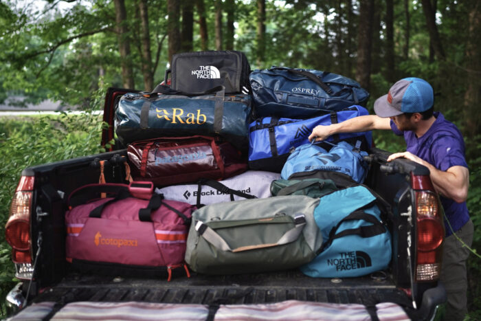
Resupply Strategy: Planning Your Logistics
You cannot carry 21 days of food; your pack would weigh 70 pounds and your knees would quit by Day 3. You need to send buckets to yourself.
- Tuolumne Meadows (Mile 23): Use the Post Office or the Tuolumne Meadows Store. This is a short carry from Yosemite Valley.
- Reds Meadow (Mile 60): Located near Devils Postpile. They have a general store, a cafe (get the burger!), and hot showers.
- Vermilion Valley Resort (VVR - Mile 87): You have to take a ferry across Lake Thomas Edison or hike around it. VVR is famous for its "hiker trash" vibe. Your first beer is free for thru-hikers!
- Muir Trail Ranch (MTR - Mile 110): This is the most critical stop. Beyond MTR, there are no resupply points for the final 100 miles until Whitney Portal (unless you hike over a side pass like Kearsarge).
Expert Tip: The "Big Carry" The 100-mile stretch between MTR and Whitney Portal is where your strategy is tested. Most hikers pack their bear canisters to the absolute limit here. I recommend shipping a bucket to MTR with calorie-dense foods (nut butters, olive oil packets, dried mango) to fuel the massive climbs over the 12,000+ ft passes.
View MTR Resupply Instructions →
Ultralight Gear Strategy for the Sierra
The JMT is a trail of extremes. It can be 80°F at the floor of Yosemite Valley and 20°F at your campsite near Garnet Lake.
- Bear Canisters: They are mandatory. Period. The BV500 is the industry standard for the JMT because it can hold about 7-9 days of food. If you’re going ultralight, look into the Wild Ideas Bearikade, though they are pricey.
- Footwear: Ditch the heavy leather boots. The JMT is well-maintained granite. I’ve hiked it twice in trail runners and never looked back. Your feet will swell at altitude—buy a half-size larger than your normal shoe.
- The Sleep System: Don't skimp on a sleeping pad. A pad with an R-value of 4 or higher is essential for those nights camping on cold granite.
Essential Skills & Safety
High-Altitude Acclimation The trail stays above 10,000 feet for the majority of its length. Acute Mountain Sickness (AMS) is real. I’ve seen strong hikers forced to bail because they pushed too hard, too fast. Drink more water than you think you need and listen to your body. If you have a persistent, crushing headache, it’s time to descend.
Swiftwater River Fords In early season (June/July), river crossings like Evolution Creek or the South Fork of the Kings River can be waist-deep and terrifying.
- Rule of thumb: Cross early in the morning when the snowmelt is at its lowest.
- Technique: Unbuckle your hip belt and sternum strap so you can ditch your pack if you fall. Face upstream and move diagonally.
Navigation While the JMT is well-marked, a "High Sierra" afternoon can bring fog and whiteouts. I always carry the FarOut (formerly Guthook) app for real-time GPS and hiker comments on water sources, but I always have a paper map (Tom Harrison JMT Map Pack) as a backup.
FAQ
How much does it cost to hike the JMT? Expect to spend between $1,000 and $2,000. This includes permits, gear upgrades, shipping resupply buckets (which can cost $50+ each in fees), and the inevitable "town feast" at VVR or Reds Meadow.
Can I hike the JMT without a bear canister? No. It is a legal requirement in Yosemite, Kings Canyon, and Sequoia National Parks. Rangers will check your permit and your canister. More importantly, it protects the bears from becoming habituated to human food.
Is there cell service on the JMT? Almost none. You might get a faint signal at the top of Mt. Whitney or near some of the resorts, but for 95% of the trail, you are off the grid. I highly recommend carrying a satellite communicator like the Garmin inReach Mini for emergencies.
The John Muir Trail isn't just a physical challenge; it’s a mental reset. There is something transformative about carrying everything you need to survive on your back for three weeks. When you finally descend those 99 switchbacks from Whitney toward the Portal, you’ll be tired, you’ll be dusty, and you’ll probably smell terrible—but I promise you, you’ll already be planning your next trip back to the High Sierra.
See you on the trail.